Chicago’s vast and vibrant landscape is best explored when you understand its efficient public transportation system. From iconic elevated trains to extensive bus routes, getting around the Windy City is surprisingly simple and accessible, even for first-time visitors. This comprehensive guide will help you master Chicago transportation, ensuring you can seamlessly navigate between world-class attractions, diverse neighborhoods, and renowned dining spots. Discover the best ways to get around, from the iconic ‘L’ train to rideshares, making your Chicago travel smooth and stress-free.
The ‘L’ Train: Chicago’s Iconic Elevated System
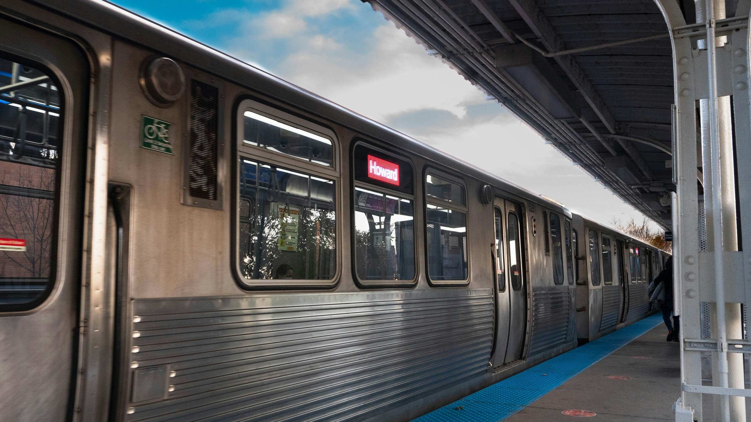
The backbone of Chicago’s public transit is the ‘L’ train, named for its elevated tracks in the downtown Loop area. This extensive rail system, operated by the Chicago Transit Authority (CTA), connects virtually every corner of the city and its immediate suburbs, offering a quick and often scenic way to travel.
Understanding the ‘L’ Lines
Each ‘L’ line is color-coded, making navigation straightforward. The Red Line runs 24/7, connecting major attractions from Wrigleyville in the north to Chinatown in the south, including the Loop. The Blue Line provides direct service to O’Hare International Airport and extends northwest, while the Orange Line links Midway International Airport to downtown. Other lines, like the Brown, Green, Pink, and Purple lines, serve various neighborhoods and offer convenient connections throughout the city. Using the ‘L’ is often the fastest way to avoid Chicago traffic.
Key ‘L’ Stations for Tourists
For visitors, key ‘L’ stations provide access to major sights. The Clark/Lake station offers easy access to the Loop and River North. For Millennium Park and the Art Institute, the Adams/Wabash or Monroe stations are ideal. To reach Navy Pier, take the Blue Line to Clark/Lake and transfer to a bus, or simply walk. The Chicago ‘L’ map is readily available at stations and online, making route planning simple.
Chicago Buses: Connecting Every Corner
Complementing the ‘L’ train, Chicago’s extensive bus network fills in the gaps, reaching areas not served by the rail system and providing convenient street-level travel.
Navigating Bus Routes
CTA buses operate on hundreds of routes, often running frequently, especially in downtown and popular neighborhoods. Bus stops are marked with clear signs indicating route numbers and destinations. Using online maps or apps like Google Maps or the CTA’s own Ventra app is highly recommended for real-time bus tracking and route planning. Buses are excellent for exploring specific neighborhoods like Lincoln Park or Hyde Park, offering a more localized Chicago travel experience.
Payment for Bus & ‘L’
The most convenient way to pay for both ‘L’ trains and buses is with a Ventra Card. These reusable smart cards can be purchased at ‘L’ stations, Ventra vending machines, or various retail locations. You can load money onto them for pay-per-ride fares or purchase unlimited ride passes (1-day, 3-day, 7-day, etc.), which are often the most economical option for tourists. Cash is accepted on buses (exact fare only), but Ventra is faster and allows for transfers.

Beyond Public Transit: Taxis, Rideshares & Biking
While the CTA provides excellent coverage, other transportation options offer flexibility and convenience.
Taxis & Rideshares
Traditional taxis are readily available throughout downtown and at major transportation hubs. Rideshare services like Uber and Lyft are also widely used in Chicago, offering convenient on-demand transportation via their mobile apps. These options are particularly useful for late-night travel, carrying luggage, or reaching destinations not directly served by public transit, providing convenient Chicago transport.
Biking in Chicago
Chicago is a bike-friendly city with a growing network of bike lanes and the Divvy bike-share program. Divvy stations are abundant, especially in central areas and along the Lakefront Trail, making it an enjoyable way to explore the city at your own pace. Biking is a fantastic option for scenic routes, particularly along the Lakefront Trail, offering active Chicago exploration.
Walking
Many of Chicago’s downtown attractions, including Millennium Park, Grant Park, the Art Institute, and the Magnificent Mile, are within easy walking distance of each other. Comfortable shoes are a must for exploring the city’s vibrant streets and stunning architecture on foot.
Mastering Chicago transportation opens up the entire city for exploration. With its efficient ‘L’ train, extensive bus network, and convenient alternative options, navigating the Windy City is an integral part of the adventure, allowing you to experience all that this incredible metropolis has to offer.